Harvests of Development in Rural Africa: The Millenium Villages After Three Years data sheet 51 Views
Author:
The Earth Institute at Columbia University
Publication Date:
May 2011
Publication Type:
Report/White paper
Abstract:
At the UN Millennium Summit in September 2000, world leaders adopted the Millennium Declaration, committing nations to a new global partnership to reduce extreme poverty and address pressing challenges of hunger, gender inequality, illiteracy, and disease. The year 2015 has been affirmed as the deadline for reaching these Millennium Development Goal (MDG) targets.
The goal is to show how an integrated approach to community-level development can translate the international MDG agreements into ground-level breakthroughs throughout rural sub-Saharan Africa. Villages are located in deeply impoverished rural areas that were considered hunger hotspots—with at least 20% of children malnourished. Sites were selected to reflect a diversity of agro-ecological zones, representing a range of challenges to income, food production, disease ecology, infrastructure, and health system development.
The Millennium Villages Project is a ten-year initiative spanning two five-year phases. The first phase focuses on achieving quick wins, especially in staple crop production and disease control, and on establishing basic systems for integrated rural development that help communities escape the poverty trap and achieve the MDGs. The Project involves the coordinated community-led delivery of a locally tailored package of scientifically proven interventions for agriculture, education, health, and infrastructure. Over the first five-year phase, interventions are delivered at a modest cost, totaling approximately $120 per capita per year, of which MVP brings about half to complement funds from the host government, the local community, and other partners. The second five-year phase will focus more intensively on commercializing the gains in agriculture and continuing to improve local service delivery systems in a manner that best supports local scale-up.
"The World Bank is a vital source of financial and technical assistance to developing countries around the world. Our mission is to fight poverty with passion and professionalism for lasting results and to help people help themselves and their environment by providing resources, sharing knowledge, building capacity and forging partnerships in the public and private sectors. We are not a bank in the common sense; we are made up of two unique development institutions owned by 187 member countries: the International Bank for Reconstruction and Development (IBRD) and the International Development Association (IDA).
Each institution plays a different but collaborative role in advancing the vision of inclusive and sustainable globalization. The IBRD aims to reduce poverty in middle-income and creditworthy poorer countries, while IDA focuses on the world's poorest countries.
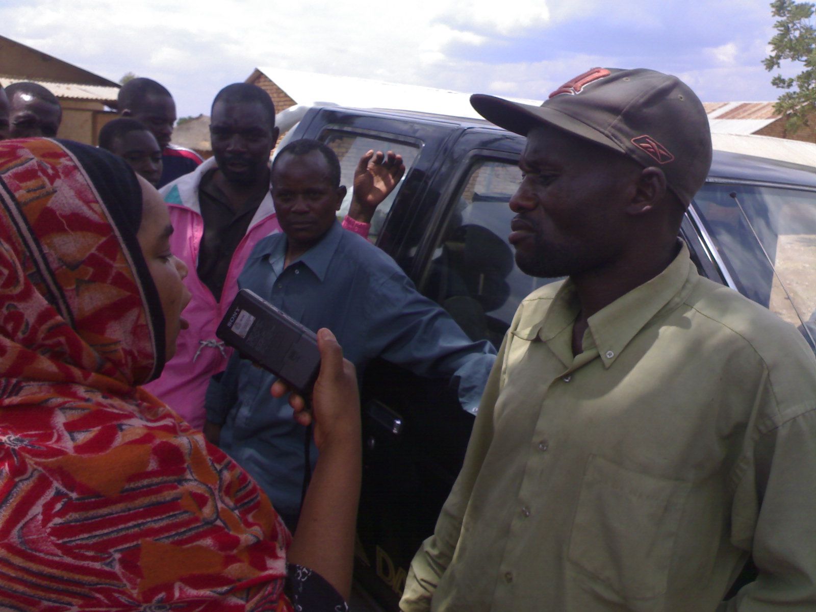
When it comes to water, every drop counts. When a local waterpoint malfunctions or dries up, it’s important to get the problem resolved as quickly as possible. That’s where Maji Matone, a water monitoring and civic participation project in Tanzania, comes in.
Run by Daraja, a Tanzania-based NGO, Maji Matone asks villagers to report outages in their water systems via SMS. Daraja employees read through the SMSs, then pass along the information to the local district engineer. The project is currently being piloted in three different districts. Each district has a local engineer responsible for the water infrastructure. If reports continue to come in and no action has been taken, Maji Matone turns to its media partners in order to publicize the lack of action.
Animation without Borders: Mobile Cartoons as a Teaching Tool data sheet 4097 Views
A team of scientists, animators, and educators are working together to create animated videos that can be sent and downloaded to mobile phones around the world. The animations can be done in any language, are targeted toward low-level literate learners, and convey methods to obtain safe water in Haiti or techniques to farm effectively in Africa, and concepts such as value in a marketplace exchange.
This University of Illinois project is called "Scientific Animation Without Borders", or SAWBO, for short. The project started about a year ago. As the team delivers the animations via mobile phone and other mechanisms, they also hope to deliver a more collaborative and bottom-up approach toward effective educational materials.
MobileActive.org spoke with university faculty and graduate students to hear more about animation, education, and mobile technology.
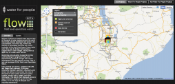
Roughly 13 percent of the world’s population still lacks access to a regular supply of clean drinking water, and monitoring current water pumps and sanitation points is an important part of making sure that areas that have gained access to clean water don’t lose it. Water for People is a non-profit organization that monitors water and sanitation points in the developing world; last February, the organization began to investigate how mobile technology could help their work and from this, FLOW was born.
FLOW (Field Level Operations Watch) is an open-source, Android application that allows field workers to use mobile phones to document how well water pumps and sanitation points in the developing world are functioning, then transmit that data to create an online tagged map of target regions.
KickStart’s mission is to help millions of people out of poverty. The organization promotes sustainable economic growth and employment creation in Kenya and other countries. It develops and promotes technologies that can be used by dynamic entrepreneurs to establish and run profitable small scale enterprises.
Today's Mobile Minute brings you coverage on the debate between native apps and web apps, an Android application that uses Spyware to mine GPS data, questions about how to define "mobile" devices, an infographic that details texting habits in the US and around the world, and a controversy over a mobile water-finding app for people crossing the Mexico/US border.
WildKnowledge (WK) are a spin out company from Oxford Brookes University in the UK. WK enables members to create and share mobile recording forms (WildForm), decision trees (WildKey), maps (WildMap) and diagrams (WildImage). These tools enable the user to make informed decisions in the field and gather good quality data. This collated data can then be uploaded and shared as part of collaborative projects. Most of our members are UK school children and students, we are keen to explore new areas both geographically and contextually. All WK applications are wep apps and can work on any device with a web browser from a mobile device to a laptop (functionality will vary according to browser's capabilities).
The Peace Corps traces its roots and mission to 1960, when then-Senator John F. Kennedy challenged students at the University of Michigan to serve their country in the cause of peace by living and working in developing countries. From that inspiration grew an agency of the federal government devoted to world peace and friendship.
Since that time, more than 195,000 Peace Corps Volunteers have served in 139 host countries to work on issues ranging from AIDS education to information technology and environmental preservation.