This how-to focuses on the tools and techniques that you can use to add location-based information to mobile content.
 Location information can add value to your stories and content and can help journalists who report on specific communities, reporters who create venue-specific multimedia, or citizen journalists who cover events in which location is relevant.
Location information has many advantages: It provides more context. It helps journalists and publishers find an interested audience; users searching for information around specific locations will most easily find information that is tagged with a location. Location information lends itself to aggregation; content with location information can be put on maps and other visualizations, which makes it more appealing for audiences to examine. Through this, it can be used in pattern-finding. Aggregations may show interesting patterns that would not be evident from individual reports. Finally, location information can leverage social media.
WARNING! That said, location data about content can expose citizen reporters and journalists and hence should be used with caution! In this how-to, we are telling you how to ADD location info, but you should also know how to REMOVE information about locations that you do not want to disclose by reading this how-to on Removing Location Information from your mobile content.
Location-tagged content is significant in journalism and news production today, for both reporters and publishers. Some current uses and platforms are listed here.
- The Online Journalism Blog showcased possibilities of using location reporting through Google latitude to present a geographic chronology of a parade.
- Al Jazeera reporters traveled into the heart of the Sahara desert, and used location tagging to tell a photo story.
- The Wall Street Journal has used location-based social media Foursquare in some experiments, using the platform for sharing news about Times Square bombings as well as restaurant reviews.
- Neighborhood narratives invites students to share stories using cell phones, GPS devices, and social network games.
- Locast is a location-based storytelling platform in which reporters and tourists tell their stories about a location using video and other tools.
- SMS incident mapping has been used in various scenarios ranging from reports from natural disasters to tracking violent crime, citizen reporting in elections.
Geocoding addresses
Following are tools and techniques that you can use to add location-based information to mobile content. We begin with the simplest way to tag content with location -- using a physical address.
Accessing location-based services on a mobile phone usually requires a smartphone that is programmable and has GPS and a data connection. For those without, the simplest way of adding location information to content is to just use addresses and other geospatial information.
Street addresses, zip codes, and other geographical data can be converted to geographic coordinates using a process called geocoding. There are many services that will let you geocode addresses worldwide (better resources are available for the US), although we have found none that you can use on a mobile without data access. On a mobile web browser, GeoNames worked well for us. There are several other geocoding APIs available which allow web and SMS applications to be built on top of them.
Locating the mobile phone automatically
Another option is to let software on your mobile phone automatically find your location. Doing this requires a phone that has GPS hardware, or one that can run software which can access your network setting.
Publishing this content to a blogging platform is the easiest way to include location. Some publishing platforms offer support through the mobile web, while others have location support when you use their apps. Besides blogging and microblogging tools, there are also specifically location-based social networking tools like Brightkite, Google Latitude and Gypsii, Four Square, Gowalla, and many more. While these may not be designed for publishing significant content beyond location, they can often be creatively used for journalistic purposes.
Another more tech-savvy approach is to develop an application that can access your mobile’s location. This can either be done by accessing the handset's GPS directly, or by using a web application that interfaces with a location-aware API. One particularly useful starting point is the open source gReporter tool. Another useful starting point is a location-based platform with an open API, like Google Latitude. By building an application using Google Latitude API, you can use the apps and features Latitude users already use for reporting location, and do something interesting with the location data. Yahoo offers a similar location-based API with Fireeagle.
Think about online platform and display
To have interesting location-based reports, journalists need to think about the online platform where the information is aggregated and displayed, in addition to the mobile phone that is uploading location information. This parade, for example, uses Google Latitude very creatively. Many tools will not be built for journalism or for publishing, but with creativity, they can be used to publish interesting and effective location-based stories.
There are limitations to adding location information to mobile content. Most importantly are security and privacy issues, especially when reporting in repressive media environments. These issues will be further addressed in the Mobile Media Toolkit.
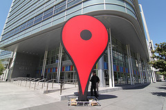
Prabhas Pokharel contributed research and writing. Photo courtesy of flickr user Mooi.
This how-to focuses on the tools and techniques that you can use to add location-based information to mobile content.
Location information can add value to your stories and content and can help journalists who report on specific communities, reporters who create venue-specific multimedia, or citizen journalists who cover events in which location is relevant.
Location information has many advantages: It provides more context. It helps journalists and publishers find an interested audience; users searching for information around specific locations will most easily find information that is tagged with a location. Location information lends itself to aggregation; content with location information can be put on maps and other visualizations, which makes it more appealing for audiences to examine. Through this, it can be used in pattern-finding. Aggregations may show interesting patterns that would not be evident from individual reports. Finally, location information can leverage social media.
WARNING! That said, location data about content can expose citizen reporters and journalists and hence should be used with caution! In this how-to, we are telling you how to ADD location info, but you should also know how to REMOVE information about locations that you do not want to disclose by reading this how-to on Removing Location Information from your mobile content.
Location-tagged content is significant in journalism and news production today, for both reporters and publishers. Some current uses and platforms are listed here.
- The Online Journalism Blog showcased possibilities of using location reporting through Google latitude to present a geographic chronology of a parade.
- Al Jazeera reporters traveled into the heart of the Sahara desert, and used location tagging to tell a photo story.
- The Wall Street Journal has used location-based social media Foursquare in some experiments, using the platform for sharing news about Times Square bombings as well as restaurant reviews.
- Neighborhood narratives invites students to share stories using cell phones, GPS devices, and social network games.
- Locast is a location-based storytelling platform in which reporters and tourists tell their stories about a location using video and other tools.
- SMS incident mapping has been used in various scenarios ranging from reports from natural disasters to tracking violent crime, citizen reporting in elections.
Geocoding addresses
Following are tools and techniques that you can use to add location-based information to mobile content. We begin with the simplest way to tag content with location -- using a physical address.
Accessing location-based services on a mobile phone usually requires a smartphone that is programmable and has GPS and a data connection. For those without, the simplest way of adding location information to content is to just use addresses and other geospatial information.
Street addresses, zip codes, and other geographical data can be converted to geographic coordinates using a process called geocoding. There are many services that will let you geocode addresses worldwide (better resources are available for the US), although we have found none that you can use on a mobile without data access. On a mobile web browser, GeoNames worked well for us. There are several other geocoding APIs available which allow web and SMS applications to be built on top of them.
Locating the mobile phone automatically
Another option is to let software on your mobile phone automatically find your location. Doing this requires a phone that has GPS hardware, or one that can run software which can access your network setting.
Publishing this content to a blogging platform is the easiest way to include location. Some publishing platforms offer support through the mobile web, while others have location support when you use their apps. Besides blogging and microblogging tools, there are also specifically location-based social networking tools like Brightkite, Google Latitude and Gypsii, Four Square, Gowalla, and many more. While these may not be designed for publishing significant content beyond location, they can often be creatively used for journalistic purposes.
Another more tech-savvy approach is to develop an application that can access your mobile’s location. This can either be done by accessing the handset's GPS directly, or by using a web application that interfaces with a location-aware API. One particularly useful starting point is the open source gReporter tool. Another useful starting point is a location-based platform with an open API, like Google Latitude. By building an application using Google Latitude API, you can use the apps and features Latitude users already use for reporting location, and do something interesting with the location data. Yahoo offers a similar location-based API with Fireeagle.
Think about online platform and display
To have interesting location-based reports, journalists need to think about the online platform where the information is aggregated and displayed, in addition to the mobile phone that is uploading location information. This parade, for example, uses Google Latitude very creatively. Many tools will not be built for journalism or for publishing, but with creativity, they can be used to publish interesting and effective location-based stories.
There are limitations to adding location information to mobile content. Most importantly are security and privacy issues, especially when reporting in repressive media environments. These issues will be further addressed in the Mobile Media Toolkit.
Prabhas Pokharel contributed research and writing. Photo courtesy of flickr user Mooi.
Post new comment